Makapu'u Point

Rock climbing above crashing waves
DATE: 31 July, 2010
TOTAL TIME: 3 hrs... I think
DIFFICULTY: Easy
PARTICIPANTS: "Reef Shoes" Jason, "Rambo" Jeremy, "Bloody" Jean, Me
REHIKE VALUE: 8

The last time I did this, I only ran up the paved road to the lookout at back. I had no idea what I was missing. Exploring Makapu'u Point has to be one of the most rewarding hikes on island. It's one of those "hiking buffets" where you can pick and choose what you want to make the perfect meal of a hike.

Left to right: "Bloody" Jean, "Rambo" Jeremy, "Reef Shoes" Jason, Me

Empty sands of Makapu'u Beach
Instead of using the paved road, we walked along the left side passing by a bunch of guys doing rappelling training off of a short cliff. The short walk continues up the left side of the hill and ends at the peak with some pillboxes from where you can walk down to the platform overlooking the lighthouse. Although the ‘peak’ was not overly high (647 ft), it provides a commanding view of the ocean, Waimanalo, Sandy Beach, and Kokohead. Great place to see humpback whales during migrating season.

Climb Aloha giving rock climbing lessons

Sentry of history overlooking the ocean

A lone lighthouse guides ships away from treacherous rocks
But what I came here for were the tide pools and the blowholes located on the south side of the hill. You can't see this area from the paved road and the climb down to it was steep but nothing to bark about. You will not regret taking this detour because it is totally worth it. The area was a natural playground for adventurists as you could pretty much make things up as you went along. There were cliffs to climb, a cave used as some kind of bird sanctuary, multiple blowholes, and clear pools you could chill-lax in if you weren't in the mood to do anything crazy. Most importantly, it's away from all those annoying Japanese tourists at the top, all of who seemed to crap their pants when they saw us scaling the rocks above the lighthouse.

Great variety, good views, easy hike. Excellent for a date, a picnic, or your walker leaning grandma. Okay, maybe without the walker, but definitely a good family outing.

Nature's resort, hidden behind the cliffs at Makapu'u

Sharp rocks line the walls of this cliff face

A double blowhole spews seawater

Cave with an ocean view

Jason's finding the best way to scale the cliff

Calm water, bored lighthouse

Pu'u Hapapa - Pu'u Kaneoha

Fading sunlight splashes orange on a cliff face
DATE: 11 July, 2010
TOTAL TIME: 5 hrs
DIFFICULTY: Easy-Medium
PARTICIPANTS: “Loafer” Mike, “The Optimist” Jeremy, Me
REHIKE VALUE: 5 (Hapapa alone)

The Hapapa – Kaneoha hike is located at the west end of Schofield Barracks. Like the Kalena hike which shares the same trailhead, you’ll need base access.

I’ve heard this hike called many things, but the name that stood out to me the most was ‘Death Ridge.’ After all the dramatic videos I’ve watched and hearing all the rah rah about dying if you make the slightest mistake, I decided it was high time to check it out for myself. Sounded exactly like something I would enjoy.

Left to right: Me, "The Optimist" Jeremy, "Loafer" Mike

The two notches known as "Death Ridge"
Including Kaneoha, the official trail spanned a distance of about 6 miles. Once you get past the peak of Hapapa, you may as well turn around because the trail is long, boring and overgrown. The portion of the trail known as Death Ridge is near the trailhead and includes two steep descents into notches along the ridge. I can testify firsthand that the name is unjustified and just a bunch of horseshit. It wouldn’t even grade high on the danger list. The ridge isn’t narrow and the descent isn’t at all hard unless you: A) have no arms, B) have no legs, C) are paralyzed, D) have a similar predicament, or E) a combination of two or more of the above. Mike damn near ran down the steep descent. Although I would not recommend running down, it just goes to show how overrated ‘Death Ridge’ is. I’ve conducted many hikes which are way more dangerous than this one, including Kalena across the street.

Mike, exploring an eroded section

Looking down at Death Ridge

Trotting down Death Ridge
I suggest future hikers try a modified trail which climbs to the top of Hapapa via the notches and back. It would cut out about four miles, and you avoid attempting Jet Li’s hundred-hand bitch slap technique against annoying plants on the overgrown trail beyond.

Forest stays silent, ignoring the hikers

This looks more like a lion, mane and all

Scrambling up rock

Meadow at sunset

Mt. Ka'ala - Dupont

Massive Mt. Ka'ala
DATE: 3 July, 2010
TOTAL TIME: 7.5 hrs
DIFFICULTY: Medium-Hard (Hard, with constant rain)
PARTICIPANTS: "Loafer" Mike, "Reef Shoes" Jason, "The Optimist" Jeremy, "Hangover" Lynnale, Me
REHIKE VALUE: 7

My goal was to recreate the journey early Hawaiians had to conduct in order to traverse Ka’ala from Waianae to Waialua, and at the end getting the modern version of ancient bloodletting and sacrificial offerings: shave ice in Haleiwa. Technically, we are combining two trails. Up the Mt. Ka'ala trail from Waianae and down the Dupont trail to North Shore.

Post-hike at Haleiwa Eats. Left to right: "Hangover" Lynnale, "The Optimist" Jeremy, "Loafer" Mike, "Reef Shoes" Jason, me

Pu'u Kanoeha and Pu'u Hapapa in the morning mist
My suck-meter was pretty maxed out on this one. Rain, rain, rain. Instead of taking the lead like I usually do initially, I let Jason do the honors. We totally missed a turn we were supposed to make and climbed up a rogue trail which ended beyond extremely thin eroded ledges at the side of a cliff, a spot we named “Jason’s Lookout.” It set us back an annoying two hours but it wasn’t his fault. I was too happy taking up the rear and was so not paying attention. Didn’t help that I never let him read the directions. My bad. Getting back to the trail was an adventure in itself as I myself took a wrong turn up a brand new trail used by the power line maintenance crew, so I did the Army ground-pounder thing and broke brush straight to the base of the correct spur.
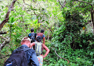
Sweet! I'm sweeping today

View from "Jason's Lookout"
All of the past hikes beginning with a steep climb did absolutely squat to prepare me for this two mile “Mud Climb to Heaven” of Mt Ka’ala. Sweet mother of God! If you’re the type to struggle climbing something like Stairway to Heaven or up from Waimano pools, just curl up in the fetal position and cry for Oprah because you will be a freaking NO GO at this one, dry or wet. Oh by the way, the first mile and a half was only a warmup. Our reward? At around an elevation of 3,000 ft, the clouds thinned a little revealing an imposing 1000 ft climb up a retarded looking cliff face with even steeper mud climbs. The cliffs went up into the clouds and little waterfalls could be seen flowing from the heavens. Did I mention it was pouring rain? Yeah, let’s just turn up the difficulty level on this just a notch shall we? Damn!
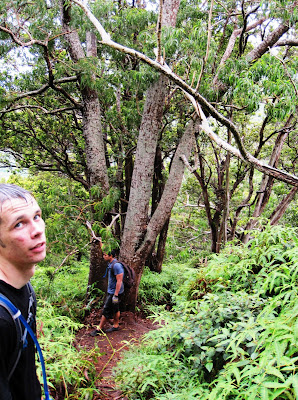
Soaking wet, we press on

Powerlines disappear into the clouds
At the peak (4,025 ft), there was a no shit swamp. A muddy swamp! On top of a mountain?!! Seriously?! Walk out of the swamp, and you'll find an FAA installation that looks like something out of Silent Hill, especially with all the mist and fog. I regret not taking more pictures for record, even though a few megapixels would never be able to fully describe the experience.

The breeze at the peak was blowing hard on our wet clothes, reminding me of one of the reasons I got out of the Army in the first place. I've never been cold in Hawaii. I was cold on this day. Fortunately, we were treated to a great downhill hike on the Dupont side over narrow ridges, rock dikes, and rock climbs, all in all ending with me finally getting that shave ice. Yes, we were wet, cold, and miserable, but traversing the old Hawaiian Trail was one of the most insane and fantastic endeavors of my existence. I would have to say it was definitely the most satisfying to complete. Super, super hike.

Muddy swamp and thick vegetation on the peak of Ka'ala

Narrow ridges on the Dupont trail

Out of the clouds, hungry for shave ice

Taking in the view of North Shore

She didn't get the memo. Bad Lynnale!

Pu'u Kalena

Rock dike off the main trail
DATE: 2 July, 2010
TOTAL TIME: 5 hrs
DIFFICULTY: Medium
PARTICIPANTS: "Loafer" Mike, Me
REHIKE VALUE: 8

Pu’u Kalena is the second highest peak on Oahu at 3,500 ft. The trailhead is located at the west end of Schofield Barracks so you’ll need someone with base access to do this one. We had ID cards so it wasn’t a problem. ‘Kalena’ roughly translates to ‘Lazy One,’ but don’t take that name literally because it will make you work to reach its peak. It is considered to be dangerous due to the narrow ridges, steep rock scrambles, and multiple rock dikes. Doomsday predictions aside, this hike is relatively short and loads of fun.

Dialing range control ... no one is answering ...

One pissed off looking rock formation
We started this one pretty early because Mike had to make it into work later in the day. I knew that Kalena would be somewhat of a challenge but the morning rain added to it, making the steep climb slow, but nice and slippery. Well, I THOUGHT it was regular morning showers, but it kept on going and going until we reached the top, so the views were non-existent till we were on our way back down.

Rain beats down as we climb uphill

Wet rock ups the challenge a little

Out of this world vegetation at the peak
What a fun hike though! Steep climbs up rock faces began almost immediately and the narrow ridges and rock dikes became narrow slippery ridges and rock dikes, adding some spice to my sadistic funhouse. The peak of Pu’u Kalena looked like freaking Degobah with mossy trees and thick brush. Would’ve been so cool to see Yoda and fly away in an X-wing not stuck in a swamp, but may also suck because the little super midget would have eaten all my snacks. There was this narrow rock dike that veered off the trail about midway through that looked retardedly unsafe, so I finagled my way through some bushes to see what it was all about. Totally neat. A definite stopover for anyone doing this hike.

Overlooking Waianae

Narrow ridges promote heavier alcohol consumption

Not for the weak or faint-hearted

One last look before heading back